GPS Map Camera App
- 2.01K
- 4.3
- Installs
- 440.00M
- Version
- Varies with device
Screenshots


Pro
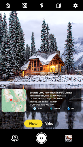
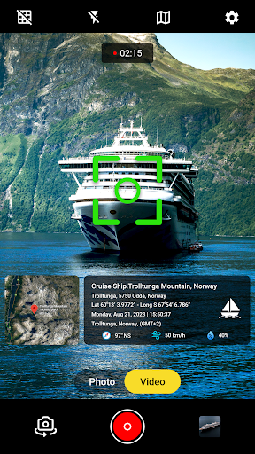
1. Geotagging Capability: The GPS Map Camera App allows users to embed precise location data into their photographs, enhancing the ability to track and organize images based on the specific places they were taken.
2. Location-Based Information: Users can access additional details like altitude, latitude, longitude, and timestamps on their photos, offering valuable context for travel enthusiasts, researchers, and professionals needing location-centric documentation.
3. Map Integration: The app integrates map views with photo capture, enabling users to visually connect their images with geographic maps, which is useful for navigation, planning trips, or creating location-focused content and memories.
Con
1. Privacy concerns: GPS Map Camera App tags photos with precise location data, potentially exposing the user's whereabouts to unintended audiences when images are shared, posing a security risk.
2. Battery drain: Constant GPS usage by the app can significantly reduce a device's battery life, necessitating more frequent charging.
3. Inaccuracy: The app's location tagging can be inaccurate in areas with poor GPS signal such as indoors or in dense urban environments, leading to incorrect geotagging of photos.